Issyk-Kul District | |
|---|---|
| Kyrgyz: Ысык-Көл району Russian: Иссык-Кульский район | |
 Lake Issyk Kul shoreline at Tamchy, Issyk Kul district | |
 Flag | |
 | |
| Coordinates: 42°39′N 77°05′E / 42.650°N 77.083°E | |
| Country | |
| Region | |
| Area | |
| • Total | 3,603 km2 (1,391 sq mi) |
| Population (2023) | |
| • Total | 98,435 |
| • Density | 27/km2 (71/sq mi) |
| Time zone | UTC+06:00 |
Issyk-Kul District (Kyrgyz: Ысык-Көл району, Isıq-Köl rayonu, ىسىق-كۅل رايونۇ; Russian: Иссык-кульский район, Issyk-kuljskij rajon) is a district of Issyk-Kul Region in north-eastern Kyrgyzstan. The seat lies at Cholpon-Ata. Its area is 3,603 square kilometres (1,391 sq mi), and its resident population was 84,876 in 2021.
Geography
The district is located on the northern shore of Issyk-Kul and on the southern slopes of the Küngöy Ala-Too Range, which dominate much of the landscape. The topography varies from multiple-folded medium-altitude mountains featuring in erosional dissection to alluvial - proluvial planes with river fans, river valleys, intermittent water streams, and lakeside planes of Issyk-Kul lake area. Approximately 78% of the district is occupied by mountains, and 22% - by valleys. The hydrological conditions are dominated by rivers Toru-Aygyr with peak flood of 30 m/s, Orto Taldy-Bulak - 6.5 m/s, Chong Taldy-Bulak - 7 m/s, Cholpon-Ata - 20 m/s, Dyure-Suu - 15 m/s, Kichi Ak-Suu - 10 m/s, Orto Koy-Suu - 10 m/s, Orto Oryuktyu - 10 m/s, Chong Oryuktyu - 20 m/s, Chet Baysoorun - 15 m/s, and Cong Baysoorun - 20 m/s.
Climate
An average temperature in January is -2°C in valleys, and -10°C in mountains. In July, an average temperature varies from +18°C in valleys, to +10°C in mountains. An absolute recorded temperature minimum is -30°. Average maximum temperatures are +35°C in valleys, and +15°C in mountains. Average yearly precipitation is 200-400 mm in valleys, and 500-600 mm in mountains during warm season (April-October), and 100-150 in valleys and 150-200 mm in mountains during cold season.
Population
| Year | Pop. | ±% p.a. |
|---|---|---|
| 1970 | 50,998 | — |
| 1979 | 58,389 | +1.52% |
| 1989 | 68,685 | +1.64% |
| 1999 | 70,677 | +0.29% |
| 2009 | 75,533 | +0.67% |
| 2021 | 84,876 | +0.98% |
| Note: resident population; Sources: | ||
Populated places
In total, Issyk-Kul District include 1 town and 30 settlements in 12 rural communities (ayyl aymagy). Each rural community may include one or several villages. The rural communities and settlements in the Issyk-Kul District are:
- town of district significance Cholpon-Ata
- Abdrakhmanov (seat: Jarkynbaev; incl. Karool-Döbö)
- Anan'yevo (seat: Anan'yevo; incl. Kök-Döbö and Chet-Baysoorun)
- Bosteri (seat: Bosteri; incl. Baktuu-Dolonotu)
- Kara-Oy (seat: Kara-Oy)
- Kum-Bel (seat: Korumdu; incl. Bulan-Sögöttü)
- Örüktü (seat: Chong-Örüktü; incl. Orto-Örüktü and Örüktü-Khutor)
- Sadyr Ake (seat: Grigor'yevka; incl. Grigor'yevka Pristany)
- Semyonovka (seat: Semyonovka; incl. Kojoyar)
- Tamchy (seat: Tamchy; incl. Kosh-Köl and Chyrpykty)
- Temir (seat: Temir; incl. Kashat)
- Toru-Aygyr (seat: Toru-Aygyr; incl. Kyzyl-Örük and Sary-Kamysh)
- Chong-Sary-Oy (seat: Chong-Sary-Oy; incl. Baetov, Örnök, Sary-Oy and Chok-Tal)

Dolonotu
Sögöttü
Pristany
Örük
Gallery
-
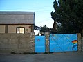 Guesthouse at Tamchy
 -
 Irrigation
 -
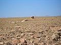 Desert above Tamchy
 -
 In the desert above Tamchy. Choktal peninsula in the background.
 -
 Sea buckthorn shrubs on the lake shore east of Kosh Köl
 -
 An abandoned resort at Kosh Köl.
 -
 On the beach at Kosh Köl.
 -
 Eastern entrance to the district.


References
- ^ a b "Classification system of territorial units of the Kyrgyz Republic" (in Kyrgyz). National Statistics Committee of the Kyrgyz Republic. May 2021. pp. 12–14.
- ^ a b "2009 population and housing census of the Kyrgyz Republic: Issyk-Kul Region" (PDF) (in Russian). National Statistics Committee of the Kyrgyz Republic. 2010. pp. 11, 16.
- ^ a b "Population of regions, districts, towns, urban-type settlements, rural communities and villages of Kyrgyz Republic" (XLS) (in Russian). National Statistics Committee of the Kyrgyz Republic. 2021. Archived from the original on 10 November 2021.
- ^ a b Мониторинг, прогнозирование опасных процессов и явлений на территории Кыргызской Республики [Monitoring and Forecasting of Natural Hazards in Kyrgyz Republic] (PDF) (in Russian) (18th ed.). Ministry of Emergency Situations of Kyrgyz Republic. 2021. p. 324. Retrieved May 20, 2021.
- ^ List of Rural Communities of Kyrgyzstan Archived 2010-02-09 at the Wayback Machine
| North Kyrgyzstan |
|  | ||||||||||
|---|---|---|---|---|---|---|---|---|---|---|---|---|
| South Kyrgyzstan |
| |||||||||||
This Issyk-Kul region location article is a stub. You can help Wikipedia by expanding it. |